
Dedicated to leisurely paced river paddling
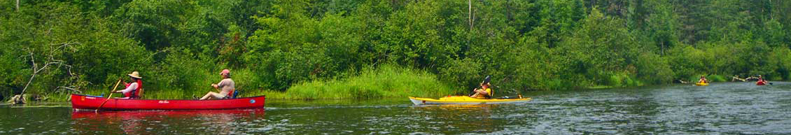
The River Ramblers is an organization dedicated to leisurely paced river paddling, with an emphasis on enjoying the great outdoors. Individual and family participation is encouraged. We have both quiet and whitewater trips. We ask for a $3 contribution per boat, per trip, or $10 year, to cover the costs of this website, keep the River Ramblers organization functioning, and support organizations that work to better our local rivers.
River Ramblers supports Friends of the Mississippi, Friends of the St. Croix, and Friends of the Kinni.
Car shuttles and trip coordinators
River Rambler trip coordinators send out the trip packets and arrange the car shuttles. Shuttles involve moving the paddler's cars to the take out or put in, depending on the river. The trip coordinator is a volunteer who has paddled the trip before, often for many years. They are coordinating trips that they themselves are going on to have fun. You will find on these trips other people who truly share an appreciation for nature, enjoyable exercise, fresh air, and adventure.
You are responsible for your own safety
Read the CODE OF EXPECTATIONS - CLICK HERE TO READ
Trip ratings designate the level of experience required to paddle a trip. In some cases trip coordinators may request your confirmation that you have the skills required to ensure the trip is safe and enjoyable for everyone. If you are unsure of your skills, ask the trip coordinator for recommendations on if the trip is right for you.
Read the Trip Summaries
Come join the River Ramblers on this 2024 paddling season, and see for yourself how fun and relaxing it can be to enjoy the beautiful rivers and creeks that surround us. The best way to find out if this is for you is to join the River Ramblers on one or more trips.
Check out the Trip Summaries to see if any of the trips sound interesting to you. Trip packets can be obtained from the trip coordinators for any trip; and they give the basics of what will be necessary to enjoyably participate on that trip including meeting time and location. Then just be at the meeting place, with the correct gear, at the designated time, ready to have a really good time. Hopefully we will see you on at least one of the rivers or creeks enjoying nature soon.
*******************************************************************************************
PADDLING FILM FESTIVAL March 19, 2024
Starts at 6 p.m., Surly Brewing, Minneapolis
The Paddling Film Festival will be on March 19, 2024, beginning at 6 p.m., organized by Rapids Riders and held at Surly Brewing, 520 Malcolm Ave SE, Minneapolis.
* Subjects include adventure paddling and many other forms.
* TICKETS available online:
*******************************************************************************************
TRIP SCHEDULE 2024
You are welcome to come for one day of multiple day trips.
***Indicates WHITEWATER TRIPS
- BEGINNER
- INTERMEDIATE
- ADVANCED
*******************************************************************************************
-
April 27 - *** HALL'S CREEK ***
INTERMEDIATE
Hall's Creek is a magnificent East Central Wisconsin Creek. This trip starts at the Trow Lake Dam in Merrillan, Wisconsin, and flows 11.5 miles south to the Black River. Hall's Creek features root beer colored water, numerous ripples, Class I & Class II rapids and sandstone rock walls and outcroppings at nearly every turn. There are few houses and only one bridge along this route which provides for a unique remote experience. This is truly some of the best paddling Wisconsin has to offer!
FMI and trip packet contact the trip coordinator: DON SCHAUB
Back to top
-
CANCELLED FOR HIGH WATER
May 4 CANNON RIVER (Cannon Falls to Welch)Beginner
TRIP CANCELLED DUE TO RECENT RAIN AND HIGH WATER CONDITIONS.
This is a 13 mile run through beautiful bluff country and hardwood forests. Depending on water level this river can range from Intermediate in high water or beginner at medium or lower water levels. Shortly after launching the Little Cannon River joins the main branch making a significant Class I rapids which can have whirlpools that tip paddlers. In places, you will have to determine the best branch of the river to take, the outside curve usually has the most water and possibly rapids, but may require quick maneuvering to avoid down trees and branches. There will be rocks and gravel bars to avoid in low water. The ability to read the river is helpful. There is a $5 landing fee to use the landing at the Welch Canoe and Kayak Outfitters.FMI and trip packet contact the trip coordinator: MARILYNN TORKELSON
Back to top
-
May 11 *** STRAIGHT RIVER (Krogh's Landing to Two Rivers Park) ***
INTERMEDIATE
Paddling the last miles of the Straight before it becomes a tributary into the Cannon, we will go under about 10 bridges in 10 miles. Early in the trip is a glacial boulder about the size of a small garage. This trip will also go through River Bend Nature Center and Teepee Tonka Park. The Straight has a quick pace with an average gradient of 6.2 ft per mile.
FMI and trip packet contact the trip coordinator: DON SCHAUB
Back to top
-
May 19 *** BLUE EARTH RIVER (Rapidan Dam to County Road 90) ***
INTERMEDIATE
The Blue Earth River got its name from the barely visible bluish-green clay deposits along the banks. We will be paddling the lower 11.9 mile stretch from the Rapidan Dam (a 475 foot wide, 87 foot high structure built in 1910 for the production of electrical power) to Hwy 90. This stretch is known for small tributaries that form picturesque waterfalls and gulches along the banks that can be seen during wet periods of the year. While the rapids on the Blue Earth River are generally Class I, it can move swiftly especially after a rainfall. We will plan to have 2 breaks along this trip, if access allows. The first being at Devils Gulch, which has a narrow, moss-covered passage (short hike) back into the valley to view a waterfall (if moisture levels are good). The second break will be our lunch stop at the amazing triple falls.
FMI and trip packet contact the trip coordinator: MARILYNN TORKELSON
Back to top
-
May 25 *** CROW RIVER ***
INTERMEDIATE
This is a 10 to 11 mile run from St Michael to the Mississippi, with the option to explore two oxbows created when Interstate Highway 94 was built about 66 years ago. It appears the Crow was rerouted 1000 feet to the southeast to avoid having bridges on the exit and entrance ramps for Hwy 241. When I paddled this a dozen years ago, I didn't know the history, but was struck by the southwest oxbow appearing to be a much older channel than the flowing river. The present channel had much less glacial drift and rock showing than the oxbow had. With a very short portage my neighbor and I paddled most of the oxbow and then rode a rivulet south almost back to the new channel. We did not explore the next oxbow northeast of I-94, so that calls out to be finished. The put in will be at the parking lot of the Crow Hassen Dog Park on County Rd 116.
FMI and trip packet contact the trip coordinator: MARK NELSON
Back to top
-
May 27 - ZUMBRO RIVER (Zumbro Falls to Millville)
Beginner
The Zumbro is a scenic river with an active current and easy Class I rapids This popular trip will take us from Zumbro Falls to Millville. Bring your camera to capture the beauty of the occasional bluff, and other natural scenery. This is a great trip, just 70 miles south of the cities.
FMI and trip packet, contact the trip coordinator: KEVIN HANNON
Back to top
-
June 1 - RUM RIVER (Cambridge to Martin's Landing)
Beginner
The Rum river is designated a Wild and Scenic river with mature forests and abundant wildlife. Prepare to see eagles, kingfishers, green and blue herons, Trumpeter swans, deer, fox and otters. This is a 7.8 mile trip (3-3.5 hours) and if you are new to river paddling, this is the perfect starter trip. The mild current, sandy bottom and clean water provide many places to swim or have a snack on a sandbar. Bring your camera, swimsuit and a lunch for a fun day on the river.
FMI and trip packet contact the trip coordinator: NANCY LUNZER
Back to top
-
June 1 *** VERMILLION RIVER (Hwy 52 to Hastings) ***
INTERMEDIATE
This section of the Vermillion is a prairie river with moderate flows meandering through farmland for the 7-mile stretch of birdwatching and enjoying nature between Hwy. 52 where we will put in and the western edge of Hastings where we will conclude our trek. There are many trees along the prairie corridor and paddling will include portages around downed trees. There also are Class I riffles as the Vermillion approaches Hastings.
FMI and trip packet contact the trip coordinator: TERI REITAN
Back to top
-
June 8-9 *** UPPER BOIS BRULE RIVER ***
INTERMEDIATE
The Bois Brule is one of the most popular rivers for canoeing and kayaking in Wisconsin. The Saturday trip will be about 11.5 miles, from Stone's Bridge to the Wisconsin DNR Bois Brule Campground. This trip goes through some lakes, several riffles, Class I rapids, and one Class II rapids that is a straight ramp type drop and can be done in an open canoe.
Day 2 we will paddle from Hwy 13 to Lake Superior, 8.2 miles. This does involve one portage at a dam. This section can be quite low and requires reading the riffles to find your route. Once we get close to the lake, we have flat water that opens to a view of the lake, wind, waves, and Superior temps. It can be dramatic.
Day 2 option: Trip coordinators will not be paddling the ledges. We can support a shuttle on Day 2 for the ledges. Request trip packet for details.
Camping is available at DNR Bois Brule Campground or options in trip packet. It is suggested that you make reservations 2 - 3 months in advance as these campsites fill up. There are motels and cabins available in the town of Brule and surrounding area.
FMI and trip packet contact the trip coordinator: JEAN BRANDES
Back to top
-
CANCELLED FOR HIGH WATER
June 8 - MISSISSIPPI RIVER (Monticello to Elk River)Beginner
With the channels of the Mississippi merged into a single broad stream, the river from Monticello to Elk River flows smoothly past wooded hills or eroded banks, through cities and pockets of residential development. The paddling distance will be about 16 miles with an average gradient of about 2 ft per mile.FMI and trip packet contact the trip coordinator: MIKE DOUGHERTY
Back to top
-
June 15 - UPPER ST. CROIX RIVER
Beginner
The Upper St. Croix offers something for everyone: Beautiful scenery, novice rapids, and slow currents. The lazy paddling from Riverside to just above St. Croix State Park takes about 4-5 hours, including a lunch stop on a sandbar. The clear water and sandy bottom allow swimming almost at will. There is free camping available at Howell Landing East for anyone wanting to take full advantage of the weekend to explore further on Sunday on your own.
FMI and trip packet contact the trip coordinator: CYNDI BARTHEL
Back to top
-
CANCELLED FOR HIGH WATER
June 22 - CROW RIVER - Hanover to DaytonBeginner
Designated a Wild and Scenic River, the north fork of the Crow River flows southeast from Lake Koronis for about 125 miles to the Mississippi River at Dayton. The roughly 40-mile stretch from upstream of Rockford to the Mississippi is generally the best for boating. Our section is 15 miles within this.The river is bordered by agriculture, prairie, and hardwood vegetation. It is forested with maple, basswood, and elm throughout Crow Hassan Park Reserve. Class I, smooth wide section, swift depending on water levels, some winding, and possible very small rapids. Put in: Riverside County Park, Hanover, MN (12258 8th St NE, Hanover, MN 55341), take out: Dayton Public Water Access/Boat Launch (16351 Richardson Ave, Dayton, MN 55327).FMI and trip packet contact the trip coordinator: JENNIFER SCHUETZ HADLEY
Back to top
-
CANCELLED
June 29 - *** APPLE RIVER ***INTERMEDIATE
This section of the Apple is happily far upstream from the tubing area which on Independence Day weekend will draw crowds of tubers. It will be a 14 mile trip, mostly flatwater, but includes an exciting section of riffles and Class I rapids, which if water level is high, could become Class II. If there are a couple participants who have a trailer for hauling multiple boats, we can do a reverse shuttle, cutting down driving time.FMI and trip packet contact the trip coordinator: MARILYNN TORKELSONBack to top
-
July 6 - *** ST. CROIX RIVER (Nelson's Landing to Soderbeck Landing) ***
INTERMEDIATE
This is a 10 mile trip through an isolated section of central Minnesota. Less than half a mile after launching, the river splits into two channels, with five miles of Class I/Class II rapids on the east channel. There are intermittent sections of rapids on the west channel, named the Kettle River Slough, which contains the mouth of the Kettle River divided by four islands. At the first mouth we will stop at a great lunch spot, where paddlers can listen to rapids while looking across the waters of both the Kettle and the St Croix.
FMI and trip packet contact the trip coordinator: MARK NELSON
Back to top
-
July 13-14 - LOWER NAMEKAGON RIVER WEEKEND
Beginner
The Lower Namekagon offers a slow pace to give you time to enjoy the scenery, bask in the warmth, observe the animals, and celebrate the lazy days of summer. Saturday we will be canoeing the shallow, sandy-bottomed section downstream from the campsite. Lunch will be at a halfway point where there are picnic tables. After lunch, we will be going past the highest sand dune in northern Wisconsin. We will also have possible swim stops where the water deepens. Saturday evening we will have time at the campsite to socialize some more around a campfire. On Sunday, we will put in upstream and paddle back to the campsite take-out. The river on this upper section again is relatively narrow, clear, shallow, and sandy, and it also has an abundance of fish, turtles, ducks, osprey, and deer.
FMI and trip packet contact the trip coordinator: CYNDI BARTHEL
Back to top
-
July 20 - *** RUM RIVER (Cambridge) ***
Beginner
We will paddle through undeveloped forests in a less traveled section of the Rum. Lunch stop is a county park. The paddle to car shuttle ratio is great with 13.5 miles of paddling and only 5 miles of car shuttle!
FMI and trip packet contact the trip coordinator: MARK DE BOER
Back to top
-
July 27 - UPPER ROOT RIVER (Parsley Landing)
Beginner
This is a gentle flowing, spring fed, peaceful river with a sandy bottom. There are a few rocks and riffles. The banks are mostly tree-lined with limestone walls and some awesome towering bluffs. Join us for a quiet paddle further from the commotion of riverside campgrounds and outfitter tours. The Root River supports over 40 species of birds including blue herons, egrets, wood ducks, red-tailed hawks, osprey, turkey vultures and bald eagles. Wooded shores harbor mammals such as deer, gray fox, red fox, coyotes, raccoons, woodchucks, squirrels, weasels, river otters and badgers. The timber rattlesnake can be found along the banks, trails and outcrops anywhere in southeastern Minnesota.
FMI and trip packet contact the trip coordinator: JOHN AND KANDY OLSON
Back to top
-
CANCELLED FOR HIGH WATER - RESCHEDULED FOR SEPT 1ST
August 3 - CANNON RIVER (Two Rivers Park to Dundas)Beginner
With the waters of the tributary Straight often doubling the size of the Cannon below Two Rivers Park, the Cannon becomes a big river which historically powered Faribault Woolen Mills and the Archibald Flour Mill just west of this trip's takeout. The larger Cannon also eroded out 200 ft bluffs towering over the river. The trip distance is about 13 miles with average gradient of about 3 ft per mile.FMI and trip packet contact the trip coordinator: DON SCHAUB
Back to top
-
August 10 - RUM RIVER (Becklin's Homestead to Cambridge)
Beginner
Starting at Becklin's Homestead Co. Park WMA to Cambridge for 9.1 miles on the Scenic and Wild Rum river. This is easy paddling with a mild current along sandy shores with occasional maneuvering around downed trees. The Wild designation means you will see abundant wildlife, as eagles, herons, kingfishers, otters, fox, deer and Trumpeter swans. So bring the camera and lunch and get out in nature for a 3-4 hour paddle.
FMI and trip packet contact the trip coordinator: NANCY LUNZER
Back to top
-
CANCELLED
August 17-18 - MIDDLE NAMEKAGON WEEKEND (Hayward)Beginner
The Upper Namekagon between Hayward and Earl, Wisconsin has a swift current with a series of moderate (Class I-II) rapids - just enough to keep it enjoyable. Bring your camera to capture the beauty of one of America's most scenic wild rivers. Wildlife abounds on this trip. Saturday night we relax at the rustic campground at Earl that is encircled by the river. The current is slow here giving us the opportunity to step into the river, float a good quarter mile and step out at the other side of the campground. On Sunday we backtrack a little and repeat the best part of the river and continue further downstream. We will be paddling about 4 hours each day.FMI and trip packet contact the trip coordinator: JENNIFER SCHUETZ HADLEY
Back to top
-
August 24 - RUM RIVER (Cambridge to Martin's Landing)
Beginner
The Rum river is designated a Wild and Scenic river with mature forests and abundant wildlife. Prepare to see eagles, kingfishers, green and blue herons, Trumpeter swans, deer, fox and otters. This is a 7.8 mile trip (3-3.5 hours) and if you are new to river paddling, this is the perfect starter trip. The mild current, sandy bottom and clean water provide many places to swim or have a snack on a sandbar. Bring your camera, swimsuit and a lunch for a fun day on the river.
FMI and trip packet contact the trip coordinator: NANCY LUNZER
Back to top
-
CANCELLED
August 31 - MISSISSIPI RIVER (St. Cloud to Clearwater)Beginner
Paddle narrow channels through the Beaver Islands at the start of our trip. The islands are a mix of public and private land. The river then widens through a mostly undeveloped landscape with bluffs. There are several public boat launches and campsites perfect for a picnic lunch stop or to stretch our legs along the way. Expect some riffles when the river levels are low and fast moving water when they are high.FMI and trip packet contact the trip coordinator: MIKE DOUGHERTY
Back to top
-
September 1 - CANNON RIVER (Two Rivers Park to Dundas)
Beginner
With the waters of the tributary Straight often doubling the size of the Cannon below Two Rivers Park, the Cannon becomes a big river which historically powered Faribault Woolen Mills and the Archibald Flour Mill just west of this trip's takeout. The larger Cannon also eroded out 200 ft bluffs towering over the river. The trip distance is about 13 miles with average gradient of about 3 ft per mile.
FMI and trip packet contact the trip coordinator: DON SCHAUB
Back to top
-
September 7 - LOWER ST. CROIX RIVER (LIMIT OF 10)
Beginner
This section of the St. Croix offers views of a heavily wooded steep-sided valley with occasional sandstone and limestone bluffs. Winding side channels and shaded backwaters offers a chance for some exploration. Springs and small streams entering the river create miniature deltas and valleys. Animals that we might see on our trip are white-tailed deer, beaver, raccoon, otter, mink, muskrat, fox and the occasional waterfowl.
FMI and trip packet contact the trip coordinator: LORI MARDOCK
Back to top
-
September 14 - *** KINNICKINNIC RIVER ***
INTERMEDIATE
Paddle the river that gives its name to River Falls, WI. This is a small twisting and turning river in a deep wooded gorge. It offers superb scenery with difficulty comparable to Rice and Minnehaha creeks. This is a favorite paddle for many of the River Rambler members. It is less than an hour from the Twin Cities and probably the most scenic paddle within that distance.
FMI and trip packet contact the trip coordinator: MARK DEBOER
Back to top
-
September 21 - ZUMBRO RIVER (Millville to Theilman)
Beginner
The Zumbro is a scenic river with an active current and easy Class I rapids. The river bottom is mostly sand and gravel. You might see eagles, herons, geese and other wildlife. Early fall color is just starting.
FMI and trip packet, contact the trip coordinator: JOHN & KANDY OLSON
Back to top
-
September 28 -MISSISSIPPI RIVER (Coon Rapids to Broadway)
Beginner
This section of the Mississippi River from the Coon Rapids Dam to Ole Olson Park in Minneapolis covers about 10.5 miles of travel. We weave our way through the islands if water levels allow. We anticipate some lovely fall colors. Eventually, the view opens up to the city scape. One has the contrast of being in a natural setting with the city rising up in front of us as we travel south bound. This is a flat water trip suitable for those able to handle October temperatures and keep themselves dry.
FMI and trip packet contact the trip coordinator: JENNIFER SCHUETZ HADLEY
Back to top
-
October 5- LOWER CANNON RIVER
Beginner
The Cannon is a fun river and only a short drive from the Twin Cities. We will paddle an 11 mile trip from Miesville Ravine Park Reserve to Highway 61. We hope to avoid most of the inner tubers at this time of year so we may have this great section of the Cannon to ourselves.
FMI and trip packet contact the trip coordinator: MARK DEBOER
Back to top
-
CANCELLED
October 12- *** RED CEDAR RIVER (Colfax WI area) ***INTERMEDIATE
Besides dams that create large impoundments in a few areas, the 100 mile long Red Cedar River moves along briskly past wooded hills, grassy fields, and idyllic countryside. The entire flowing parts of this medium sized river have a gradient of about 4 ft per mile with virtually no rapids so it feels like a smooth downhill paddle.The 14 mile (around 5 hours on the water) trip chosen for this day is one of my favorite sections. About a 90 minute drive east of the Twin Cities the river above Colfax and beyond has the strong river current and beautiful scenery that make the Red Cedar such a great place to explore. This trip is intermediate due to strong current and likely cool fall weather.
FMI and trip packet contact the trip coordinator: STEVE KUHNBack to top